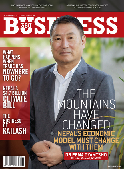
THE MOUNTAINS HAVE CHANGED. NEPAL’S ECONOMIC MODEL MUST CHANGE WITH THEM


Dr Pema Gyamtsho, Director General, ICIMOD
Rasuwa exposed a risk that extends far beyond the mountains. When glaciers, rock and water collide with highways, hydropower plants, trade corridors and settlements, climate risk becomes economic risk. ICIMOD Director General Dr Pema Gyamtsho argues that Nepal can no longer invest billions in infrastructure using assumptions drawn from the climate of the past.
For Nepal, the Rasuwa disaster should be read not only as an environmental catastrophe but as an economic warning.
In a matter of moments, a cascading mountain hazard demonstrated how exposed some of the country’s most valuable assets are: hydropower projects, highways, cross-border trade infrastructure, settlements and supply chains. And as Nepal prepares to invest billions more in energy, connectivity, tourism and urban development, the question is no longer simply how quickly the country can build. It is where it builds, how it builds and whether what it builds can survive the risks of a changing Himalaya.
That changes the conversation around climate change.
For years, climate risk has largely occupied the territory of environmental policy, development discourse and international climate negotiations. But when a power plant can be damaged, a trade corridor severed or a major infrastructure investment stranded by an event that existing engineering assumptions failed to anticipate, climate risk becomes something else: financial risk.
Dr Pema Gyamtsho believes that distinction is becoming impossible for governments, businesses and investors to ignore.
Gyamtsho joined ICIMOD as Director General in October 2020, becoming the first Director General from the Hindu Kush Himalaya region since the organisation was established in 1983. A PhD in natural sciences from the Federal Institute of Technology in Zurich, he brings more than three decades of leadership across climate change policy, natural resource management and environmental protection, and previously served as Bhutan’s Minister of Agriculture and Forests.
From Rasuwa to the Thame flood in the Everest region, recent disasters point to what Gyamtsho describes as a new reality for the Hindu Kush Himalaya: complex, multi-hazard and cascading events that conventional disaster-management systems were not designed to handle.
The implications reach directly into Nepal’s development model. Historical climate and flood records may no longer provide sufficient protection for investments expected to operate for decades. Early-warning infrastructure itself can be destroyed by the disasters it is intended to detect. Roads and settlements have moved deeper into vulnerable river corridors. And hazards originating high in the mountains can disrupt economies and infrastructure hundreds of kilometres downstream and across national borders.
For business, the message is particularly consequential. Climate risk can no longer be relegated to an environmental impact assessment or an ESG discussion after the investment decision has been made. It increasingly belongs at the beginning of that decision: in site selection, engineering design, financing, insurance, asset valuation and capital allocation.
In a wide-ranging conversation with Business 360, Dr Gyamtsho discusses what Rasuwa reveals about the changing Himalaya, why Nepal and other Himalayan countries, may need to rethink where it places billions in infrastructure investment, the technologies that could buy communities precious minutes before disaster strikes, and why climate resilience must now become part of the economics of growth.
The Rasuwa disaster has raised serious questions about whether Nepal is entering a new era of mountain hazards. From ICIMOD’s scientific perspective, what does this event tell us about how the nature, frequency and intensity of disasters in the Hindu Kush Himalaya are changing?
Historically, our approach to disaster management focused on isolated, single-event occurrences. Today, we are coming to terms with a far more complex reality – multi-hazard, cascading disasters where one trigger event sets off a catastrophic chain reaction.
In the case of Rasuwa, an initial rock and ice collapse triggered a massive, high-velocity flow of debris, mud and ice. As this mass moved downward, secondary slope failures added significant volume and momentum. Cascading hazards are no longer a theoretical projection. They are our current reality.
The critical challenge with these events is that they are extremely difficult to detect or predict in real time. The underlying structural destabilisation occurs subsurface across vast, rugged mountain terrain. Identifying the exact location where a failure will occur poses an immense technical hurdle.
Furthermore, our legacy early-warning infrastructure was never designed for events of this magnitude. Standard setups for Glacial Lake Outburst Floods (GLOFs) or flash floods typically position monitoring stations directly along riverbanks. When a multi-hazard debris flow occurs, these installations are destroyed almost immediately, severing real-time communication channels when they are needed most.
We must fundamentally rethink our monitoring frameworks. We need early-detection systems situated in safer, high-altitude locations above potential flood channels, alongside robust protocols to share critical hazard data rapidly across local and national borders.
How much of the Rasuwa disaster can reasonably be linked to climate change, and where should we be cautious about making a direct attribution? What specific changes in glaciers, snow, permafrost and precipitation are increasing the risk of such cascading disasters?
Rigorous scientific investigations are ongoing and a complete picture will emerge as data collection continues. However, the role of long-term climate trends as a primary preconditioning factor is clear.
The Hindu Kush Himalaya is experiencing elevation-dependent warming, meaning higher altitudes are warming at roughly twice the global average rate. This sustained temperature rise accelerates glacial melt and thaws high-altitude permafrost. As surface ice melts, water seeps into bedrock fractures, freezes, expands and systematically weakens the structural integrity of mountain slopes. Over time, these combined processes create severe structural instability.
At the same time, regional geodynamics play an important baseline role. The Himalayas are a young, seismically active mountain range. Tectonic events, such as the lingering structural stresses from the 2015 Gorkha earthquake, can destabilise rock structures on adjacent slopes, leaving them vulnerable to future failure.
Determining exact attribution for a single event requires evaluating a complex intersection of factors. While there may not have been an immediate localised weather trigger like extreme rainfall on the day of the failure, long-term warming weakened the mountain’s structural foundation over years. To build comprehensive models, we need interdisciplinary efforts uniting glaciologists, climatologists, seismologists, hydrologists and meteorologists. What remains indisputable is that accelerating climate impacts are systematically heightening risk profiles across the entire range.
-1792062742.jpg)
ICIMOD has raised concerns about mountain environmental risks for years. Has there been a disconnect in how governments and regional stakeholders prioritise scientific warnings?
There is a clear gap between scientific research, policy formulation and ground-level execution. Science must inform decision-making far more directly than it currently does.
To bridge this disconnect, ICIMOD has expanded its engagement beyond executive ministries to work directly with parliamentarians and legislators. Parliamentarians represent vulnerable local constituencies and understand regional priorities. Crucially, they oversee resource allocation, approve national budgets and shape legislative priorities. Engaging lawmakers directly helps align scientific risk assessments with policy frameworks and funding mechanisms.
Recent years have brought a series of severe environmental warnings across the region, from the Rasuwa events to the Thame disaster in the Everest region. Treating these events as temporary alarms is no longer sufficient. They represent a fundamental shift in risk levels that demands immediate policy and infrastructure adjustments.
Given the cross-border nature of these mountain hazards, how vital is regional cooperation in managing climate risk?
High-altitude hazards operate entirely independently of political boundaries. A failure on a remote, glaciated peak in one country can trigger a debris flow that impacts infrastructure and communities hundreds of kilometres downstream in another.
No single nation can address these interconnected systemic risks in isolation. Upstream and downstream regional partners, including Nepal, Bhutan, India, Pakistan and China, must establish shared mechanisms for data integration, disaster monitoring and early-warning communications.
When climate impacts unfold across river basins, disaster risk reduction must be approached as a joint regional commitment. Strengthening cross-border scientific collaboration, real-time data exchange and coordinated emergency protocols are essential to building long-term resilience across the Hindu Kush Himalaya.
The disaster appears to have involved a complex chain of events involving ice, rock, water and debris. Are Nepal’s existing disaster-risk models capable of capturing these compound hazards, or do we need to fundamentally rethink how mountain risks are assessed?
We urgently need to synthesise what we know and identify what we still do not know. Because the nature of these hazards and risk factors is evolving continuously, putting in place a 100% foolproof monitoring or early-warning system across such vast and complex terrain is a formidable challenge.
However, our immediate priority must be identifying similar high-risk ‘hotspots’ across the region, such as the Langtang Lirung glacier area in Nepal, as well as comparable vulnerable geological formations across the Hindu Kush Himalayan mountain ranges. Once these hotspots are mapped, we must focus on upgrading localised monitoring networks, refining early-warning systems and executing granular vulnerability assessments along entire river corridors.
We have to map exactly who and what is exposed how many settlements, bridges, transmission lines and hydropower projects lie in the path of potential cascading flows.
We also have to confront a harsh truth. There is virtually no such thing as an entirely ‘safe place’ in steep mountain geography, and moving communities or infrastructure to safer terrain carries immense financial and social costs. Building back better requires significant resource commitment.
During our recent high-level convening, we brought in experts from Switzerland who managed the massive rockslide above the village of Blatten last year. In that event, local authorities successfully evacuated an entire village two days before the collapse because they used advanced monitoring technology to track the progression of deep structural cracks in real time. Remarkably, not a single life was lost to the main event.
This proves that early-warning systems are only half the equation. The other half is strict public compliance. In our region, when a flood alert sounds, people often run towards the riverbanks to watch or document the event rather than evacuating to higher ground. Elevating compliance and changing public awareness are just as vital as installing sophisticated sensors.
Rasuwa is an important economic corridor featuring major hydropower projects, vital road networks, cross-border trade hubs and the Kailash-Mansarovar pilgrimage route. What does this disaster tell us about the vulnerability of Nepal’s mountain economy?
It highlights how deeply exposed our primary economic arteries are. Whether in coastal zones facing cyclones or mountain valleys facing debris flows, absolute safety does not exist. The urgent policy task now is identifying relative safety zones for critical infrastructure.
Take the Rasuwagadhi (Kyirong) border port, for instance. A fundamental economic and diplomatic question now facing both Nepal and China is whether it remains feasible to reconstruct major trade infrastructure on the exact same vulnerable spot.
What is the probability of a recurring flood or a secondary collapse of the remaining unstable glacial mass upstream? These questions must be rigorously evaluated before billions in capital are committed to rebuilding the port, connecting highway corridors and damaged power plants.
Governments must evaluate alternatives, such as alternative trade routes or structural bypasses like tunnelling. Because these hazard zones span international borders, a disaster in a shared corridor impacts trade, macroeconomic stability and bilateral commerce simultaneously. Neither Nepal nor China can resolve these issues in isolation.
We need stronger transboundary dialogue and technical cooperation. China possesses advanced technological tools and engineering capabilities that can be shared jointly to model risk, engineer safer infrastructure solutions and protect cross-border trade corridors.
Several hydropower projects and major civil works were severely affected. Has Nepal been designing critical infrastructure based on historical climate and flood data that are no longer reliable? Should climate projections become a mandatory part of infrastructure planning and investment decisions?
Absolutely. Climate-risk analysis and forward-looking hydrological projections must become mandatory standard operating procedure across every stage of infrastructure development, from initial feasibility studies and engineering designs to financing and construction.
Without factoring in dynamic climate risks, a power plant inaugurated today could be completely wiped out tomorrow.
This presents a massive dilemma for policymakers, state planners and commercial investors alike. Is it sustainable to continue pouring billions into massive, single-site mega-hydropower projects along high-risk river corridors? Or should we pivot towards building more distributed, smaller-scale and manageable hydropower facilities across multiple river basins to spread risk?
These are tough choices that cannot be postponed. Mountain economies can no longer rely on century-old historical weather data or traditional flood-return periods to design dams, bridges and highways. The baseline environmental conditions have permanently changed.
-1792062815.jpg)
For business leaders, financial institutions and private investors, what should be the biggest strategic takeaway from Rasuwa? Should climate and disaster risk now be treated as a core financial and investment risk rather than primarily an environmental or corporate responsibility issue?
From a practical perspective, climate risk must be treated as a central variable in capital allocation and financial risk management. Investors can no longer afford to treat environmental impact as an afterthought or a secondary compliance check.
We need to conduct comprehensive, sector-wide risk reassessments. In the energy sector, we must bring together hydrologists, mountain engineering experts, private developers and institutional investors for intensive technical sessions.
We need to define what risk-management and structural-safety mechanisms are required – evaluating structural retrofits, early-detection software and advanced tools such as Artificial Intelligence and remote sensing to monitor slope stability in real time.
This sector-by-sector rethinking must extend beyond energy to agriculture, supply-chain logistics and tourism. When a disaster strikes a valley, relocating or rebuilding entire municipal centres or commercial hubs like Nuwakot poses massive economic and spatial challenges. Where do you move an entire town when flat, safe land is scarce?
Ultimately, treating climate hazards as a core financial risk is the only way to safeguard capital, build resilient physical assets and protect the long-term livelihoods that sustain our mountain economy.
Nepal is planning substantial investment in hydropower, roads, tourism and other infrastructure in mountain regions. How can the country continue to pursue this economic opportunity without creating infrastructure that becomes increasingly exposed to climate-related hazards?
We cannot adopt a fatalistic mindset that halts economic development. Communities must earn livelihoods, businesses must generate revenue and national economies must grow. We cannot simply abandon tourism or cease developing hydropower.
The strategy lies in shifting capital allocation from high-risk environments to lower-risk zones. While we cannot control baseline environmental changes or extreme mountain geodynamics, we exercise full control over site selection, infrastructure design, scale and density. Hard choices must be made to align economic ambitions with environmental realities.
At the same time, we must confront human drivers of environmental degradation. Climate change is a major global factor, but localised environmental mismanagement amplifies these vulnerabilities. Unengineered road construction and reckless bulldozing on fragile hillslopes invite immediate slope failures.
Nepal was historically a pioneer in developing eco-friendly road construction guidelines. In fact, during my tenure as a minister in Bhutan, I invited Nepali road engineers to help establish environmentally sound infrastructure codes for our country. Nepal possesses robust building and engineering codes on paper, but enforcement remains a major challenge.
Furthermore, over-saturation of human activity on fragile alpine peaks, ranging from excessive mountaineering footprints to heavy commercial helicopter traffic, exerts severe thermal, acoustic and physical pressure on delicate glaciers and snowfields. Unregulated tunnelling, mining and localised pollution accelerate mountain instability.
We cannot expect fragile ecosystems to adapt to unsustainable human activity. We must adapt our operational methods to respect the physical limits of the mountain environment.
Could you put the economic cost of disasters such as Rasuwa into a broader perspective? Beyond the immediate destruction of physical assets, what are the less visible costs through lost electricity generation, disrupted trade, tourism, employment, supply chains and public finances?
The true scale of such disasters far exceeds destroyed physical assets. First and foremost is the human cost: the lives lost, families displaced and widespread psychological trauma, which can never be quantified in monetary terms.
In cross-border corridors like Rasuwa, disasters affect international workers, tourists and families across multiple nations, making this a shared international concern.
In terms of economic impact, preliminary government estimates put direct physical losses for this single event at around $4 billion, a figure that continues to rise as damage assessments proceed. However, the indirect economic losses are vastly larger: halted cross-border trade, lost power generation from damaged hydropower stations, interrupted supply chains, wiped-out local employment and long-term strain on public finances.
When you aggregate lost economic opportunities across trade, agriculture and tourism, the compounding economic toll becomes immense. The global community must recognise that supporting climate resilience in the Hindu Kush Himalaya is a global imperative, given how deeply interconnected our economic, environmental and human systems have become.
ICIMOD has extensive expertise in satellite monitoring, glacier science, climate data and early-warning systems. What technologies are available that could help Nepal better anticipate or prepare for events of this magnitude?
Modern technology offers transformative capabilities, provided it is deployed appropriately and backed by actionable response protocols.
Today, high-resolution satellite remote sensing, synthetic aperture radar (SAR) and space-borne monitoring allow scientists to track minute surface displacements and structural crack developments on remote mountain slopes before catastrophic failures occur.
In addition, advanced seismic monitoring arrays can capture anomalous subsurface signals triggered by deep rock fracturing or initial ice shifts. When integrated with automated early-warning stations positioned at safe, high-altitude vantage points, these systems can transmit automated alerts seconds or minutes before a debris flow reaches downstream settlements.
Artificial Intelligence and predictive machine-learning models are also enabling scientists to process complex climate and geological datasets to identify high-risk hotspots.
However, technology alone is incomplete. Satellite feeds and automated sensors must be linked directly to municipal evacuation plans, legislative policy frameworks and well-rehearsed public-safety protocols to ensure that scientific alerts translate into saved lives and protected economic assets on the ground.
-1792062879.jpg)
There is widespread consensus that when Nepal’s leadership presents its case on global platforms such as the UN General Assembly, climate finance must be central to the address. From your perspective at ICIMOD, what core arguments should Nepal put forward?
We must put a human face on this issue. Beyond the technical figures, it is about the haunting human reality people watching their family members swept away or losing their homes and every asset they have built over a lifetime in a matter of seconds. We need to appeal directly to the global community: What will you do to help us?
While global mitigation remains crucial, look at Nepal’s reality. Our contribution to global greenhouse gas emissions is negligible. Yet warming across our mountain region is occurring at twice the global average. Our glaciers are retreating rapidly, critical water sources are vanishing and the nature of mountain hazards is changing.
We are experiencing a stark rise in the frequency, intensity and unpredictability of disasters, overwhelmingly driven by forces originating far beyond our borders.
The government must take a resolute stand on adaptation support and loss and damage. We need to resettle displaced communities, but where? We need to rebuild, but how do we fund it? These costs are enormous.
The international community must support us through direct investments in technology, capacity building and viable alternative economic solutions. Building cross-border and global cooperation is no longer optional. It is a fundamental necessity for survival.
Science and monitoring capabilities are advancing rapidly. Where does the biggest gap remain between having the technology and actually protecting people on the ground?
Science and technology exist, but the missing bridge is translating scientific data into actionable policy and ground-level practice.
It is unrealistic to expect any system to pinpoint the exact moment or location of every slope failure across the entire Himalayan range. That would require continuous, 24-hour monitoring of vast, inaccessible terrain. However, we can drastically improve our preparedness.
Learning from events like Rasuwa, we must map and focus our resources on critical, high-risk zones.
This requires establishing early-warning systems along complete river corridors, from the glacial source down to the plains. High-altitude science is useless if the warning does not reach the family living on the riverbank downstream in time.
Additionally, national scientists across Nepal, China and India are producing world-class research. ICIMOD’s core mandate is to bring these scientific findings together, turn them into practical policies and facilitate data-sharing across international borders.
But regional institutions can only deliver if member countries demonstrate the appetite and political will to cooperate and share data freely. We are owned by our member states. Our capacity to act depends on what they enable us to do.
Nepal has invested in early-warning systems for floods and glacial lake outburst floods, yet mountain disasters can develop extremely rapidly. What are the biggest gaps between scientific information being available and that information actually reaching communities, businesses and infrastructure operators in time?
The primary gap lies in the ‘last mile’ of communication and local readiness. We often have hydrological or meteorological data captured at monitoring stations, but translating that raw data into localised, plain-language risk alerts remains slow.
When a multi-hazard event or flash flood triggers high up in a glacial catchment, the lead time is measured in minutes, not days. If the warning system relies on manual verification chains or complex institutional bureaucracies before an alert is dispatched, the window to evacuate closes.
Furthermore, infrastructure operators like hydropower plants, bridge contractors and highway authorities are rarely integrated into real-time hazard networks. Warnings must be automated, multi-channel and directly linked to local emergency action plans.
A warning is only as good as the response it triggers.
If local authorities, businesses and citizens do not know precisely where to move or what protocols to execute the moment an alarm sounds, the science fails to fulfil its ultimate purpose, which is saving lives.
There is often a tendency after a disaster to focus heavily on immediate relief and reconstruction. What should Nepal do differently during reconstruction in Rasuwa to ensure it does not simply rebuild roads, bridges, settlements and infrastructure in the same risk-prone manner?
Reconstruction must be driven by strict compliance and spatial planning rather than quick fixes. If we rebuild in the exact same exposed locations, using identical materials, standard engineering models and outdated designs, we are guaranteeing that the next disaster will bring the exact same destruction.
The government must explicitly regulate where to build, how to build and what materials to use, and then rigorously enforce those rules.
If you are cutting a road through a mountain slope, do it with proper environmental safeguards. Bulldozing slopes without understanding subsurface drainage or geological stability inevitably triggers mass land failures. You end up with a temporary road, but the productive agricultural land or intact ecosystem above and below it is destroyed forever.
We must also look at historical patterns. Historically, mountain communities in Nepal did not settle right along active riverbanks. They built higher up on stable slopes or ridges. Modern development pushed infrastructure down into narrow river valleys and settlements naturally followed the roads. We moved directly into the path of natural river corridors.
In Kathmandu, whenever the Bagmati floods, people cry, ‘Khola aayo! Khola aayo!’ – the river has come. But the reality is the exact opposite. The river did not enter our domain. We encroached upon the territory of the river.
We revere rivers in our cultural traditions, yet we pollute them with sewage and garbage, build on their banks and expect no consequences. We must align our cultural reverence for nature with our practical development decisions.
-1792063048.jpg)
Nepal frequently argues internationally that vulnerable mountain countries deserve greater financial support for adaptation. What specific form of climate finance does Nepal actually need, and where is the international system currently falling short?
The international financial architecture falls short because it primarily provides fragmented, project-based financing that is slow to disburse and heavily burdened by administrative hurdles. Mountain adaptation requires flexible, predictable and direct programmatic funding.
First, Nepal needs highly concessional finance and direct grants, not debt-creating loans, specifically earmarked for resilient mountain infrastructure. Standard global climate funds often treat mountain regions through generic coastal or lowland adaptation lenses, missing the dynamic, cascading nature of Himalayan hazards where an ice-rock failure upstream transforms into a catastrophic debris flow dozens of kilometres downstream.
Second, we need dedicated funding for cross-border risk management and regional data networks.
Climate hazards do not respect national borders. Yet global climate-finance mechanisms are designed almost exclusively for country-by-country allocation, making it exceedingly difficult to secure funding for joint, transboundary early-warning systems or shared basin-level monitoring.
International climate finance must create fast-track mechanisms for multi-country, high-altitude mountain-risk initiatives.
Should Nepal consider introducing a mandatory national framework for climate-resilient infrastructure that requires every major project to account for future climate scenarios, cascading hazards and evolving risk baselines?
Absolutely. A mandatory framework for climate-resilient infrastructure is long overdue.
Historical climate data is no longer a reliable guide for future engineering standards. What used to be a ‘100-year flood event’ is now happening every decade or even multiple times within a single decade.
Every major infrastructure investment, whether a major highway, a hydropower plant or a municipal bridge, must undergo multi-hazard risk assessments before approval.
These assessments cannot look at isolated risks. They must evaluate cascading scenarios. For example, a heavy rainfall event triggering a landslide that blocks a river, which then breaches and destroys downstream infrastructure, must be modelled during the design stage.
Enforcing building codes, environmental impact assessments and strict spatial zoning must become central to national development policy. Infrastructure designed today must be built to withstand the extreme climate realities of tomorrow.
Finally, what is your message to Nepal’s policymakers and business leaders after this latest disaster about how the country must rethink economic development in its mountain regions?
First and foremost, we must move beyond denial. Climate change is here and its impacts on our mountains are a daily reality. We cannot treat disasters as isolated, one-off events that will not happen again for another century. Complacency is our biggest threat.
Acceptance must be followed by systematic action: integrating monitoring, early warning, structural safety and policy compliance.
Nepal possesses all the necessary ingredients for a prosperous, sustainable future. You have exceptional human capital, highly skilled Nepali scientists, engineers and professionals working in top institutions worldwide. You have vast natural wealth, abundant water resources, rich cultural assets and extraordinary geography.
The critical key is responsible management.
Consider mountain tourism and mountaineering. Out of the world’s 14 8,000-metre peaks, Nepal is home to eight. Why rush to crowd thousands of climbers onto these peaks every single season? We could introduce sustainable concepts, such as giving individual peaks periodic rest years to recover ecologically.
We must adopt the same responsible approach across cultural, religious and eco-tourism, from Muktinath, Pashupatinath and Lumbini to our high-altitude landscapes.
If Nepal manages its natural, cultural and human assets responsibly and sustainably, there is no reason for the country to remain economically constrained. The potential is immense.
The challenge for leaders today is turning that potential into responsible, climate-resilient action.