Nepal proposes regional space cooperation for monitoring climate risks

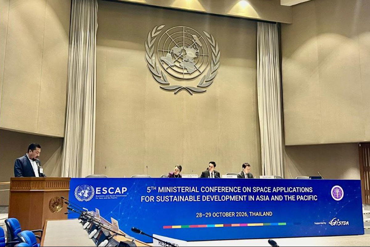
KATHMANDU: Nepal has proposed three measures to strengthen disaster preparedness and climate risk monitoring through regional cooperation at the 'Fifth Ministerial Conference on Space Applications for Sustainable Development in Asia and the Pacific' underway in Bangkok, Thailand.
Addressing the conference organised by the United Nations Economic and Social Commission for Asia and the Pacific (ESCAP) on Wednesday, Minister for Energy, Water Resources and Irrigation Biraj Bhakta Shrestha called for enhanced Asia-Pacific cooperation in the use of space technology to address growing climate-related disasters.
Minister Shrestha urged countries in the region to make high-mountain hazards a sustained priority of regional space cooperation through systematic satellite monitoring of unstable slopes and glacial lakes. He also stressed the need to convert satellite data into practical information for timely action and called for equitable and affordable access to space-based information and services for all countries.
“Nepal wishes to highlight three priorities for our collective consideration. First, establish high-mountain hazards as a sustained priority of regional space cooperation. We encourage systematic satellite monitoring of unstable slopes and glacial lakes as an integral part of regional monitoring and early warning arrangements. Second, turn data into practical guidance for timely action. Alongside access to satellite imagery, countries need ready-to-use information, shared analytical tools and trained professionals who can support informed decisions when every minute matters. Third, ensure equitable and affordable access to space-based information and services. All countries should be able to benefit from these capabilities, regardless of whether they operate their own satellites, particularly when human lives are at risk,” he said.
The minister said Nepal’s recent experience had highlighted the urgent need to strengthen capacity to understand and respond to complex disasters. He noted that nearly 680,000 text warnings were sent to mobile phones along the Bhotekoshi-Trishuli river corridor on August 26, while around 200,000 additional alerts issued in October helped communities downstream move to safety.
Minister Shrestha also cited a study by the International Centre for Integrated Mountain Development (ICIMOD) and the United Nations Development Programme (UNDP), which identified 47 potentially dangerous glacial lakes across three Himalayan river basins shared by Nepal, China and India. Of these, 21 are located in Nepal.
“With the Green Climate Fund and UNDP, Nepal has begun work to lower and monitor four of the most dangerous: Thulagi, Lower Barun, Lumding and Hongu,” he said.
Highlighting the role of space technology in disaster risk reduction, Shrestha said many hazardous mountain slopes and glacial lakes remain inaccessible, making continuous satellite observation essential. He also called for the use of artificial intelligence and digital simulations to improve hazard assessment and early warning systems.
“A satellite can detect a danger in the mountains. Only a warning that reaches a family downstream can save a life. The river systems of the Hindu Kush Himalaya support the lives and livelihoods of nearly two billion people. Their protection is a shared regional responsibility,” he said.
The minister also underscored the importance of ensuring practical outcomes from regional initiatives as the Asia-Pacific Plan of Action advances towards 2030.
Minister Shrestha who is in Thailand is also scheduled to address an event at the Asian Institute of Technology on Thursday and is due to return to Nepal on Saturday.